Short Answer
During the War of 1812, roads and transportation networks were decisive in shaping military operations on the North American continent. The primitive roads of the era, coupled with a heavy dependence on lakes and rivers, determined where armies could march, how supplies were delivered, and why certain campaigns succeeded or failed. This article examines the state of routes, the movement of forces and goods, and the profound impact that infrastructure had on the conflict.
Historical Context
At the outset of the war, both the United States and British North America were sparsely settled, with transportation infrastructure that reflected the limits of colonial development. Settlement hugged the Atlantic coast and navigable rivers; interior regions like the Old Northwest and Upper Canada were accessible mainly by water. The Great Lakes, the St. Lawrence River, and Lake Champlain formed natural highways that linked isolated communities and military posts. Land travel was difficult: roads were often little more than cleared paths, suitable for packhorses and light wagons only in dry weather. Mud, frost, and forest obstructed movement during much of the year.
Both belligerents recognized the strategic importance of waterways. British North America relied on the St. Lawrence and the lakes to supply its far-flung garrisons and allied Indigenous communities. The United States, with a larger population but a poorly organized army, struggled to project power over long overland distances. Indigenous peoples, who had extensive knowledge of regional trails and river routes, played a crucial role as guides, scouts, and combatants.
What Happened
The early American invasions of Canada in 1812–1813 were severely hampered by inadequate overland supply lines. General William Hull’s march from Ohio to Detroit, for example, involved a long, arduous route through wilderness, and his army’s transport broke down in the swampy terrain of the Maumee River valley. The disastrous surrender of Detroit in August 1812 owed much to Hull’s fear of being cut off from supplies due to poor roads and British control of Lake Erie.
On the Niagara frontier, troops and artillery were moved along narrow rutted roads between Fort Niagara, Lewiston, and Queenston. In October 1812, after the Battle of Queenston Heights, American reinforcements were unable to cross the Niagara River quickly because of a lack of boats, a logistical failure that turned a potential victory into a defeat. Similarly, the American campaign toward Montreal in 1813—the advance down the Chateauguay River—was stymied by difficult terrain and insufficient transport, leading to a retreat.
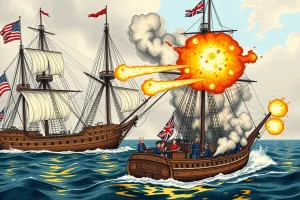
Waterways, however, proved more decisive. The Americans built a fleet at Erie, Pennsylvania, under Oliver Hazard Perry, and transported ships’ stores overland from the falls of Niagara to Lake Erie. Perry’s victory at the Battle of Lake Erie in September 1813 gave the United States control of that lake, forcing the British to abandon Detroit and York. On Lake Champlain, the American naval victory at the Battle of Plattsburgh in September 1814 stopped a British invasion from Canada. In both cases, the ability to launch and supply ships overcame road-based limitations.
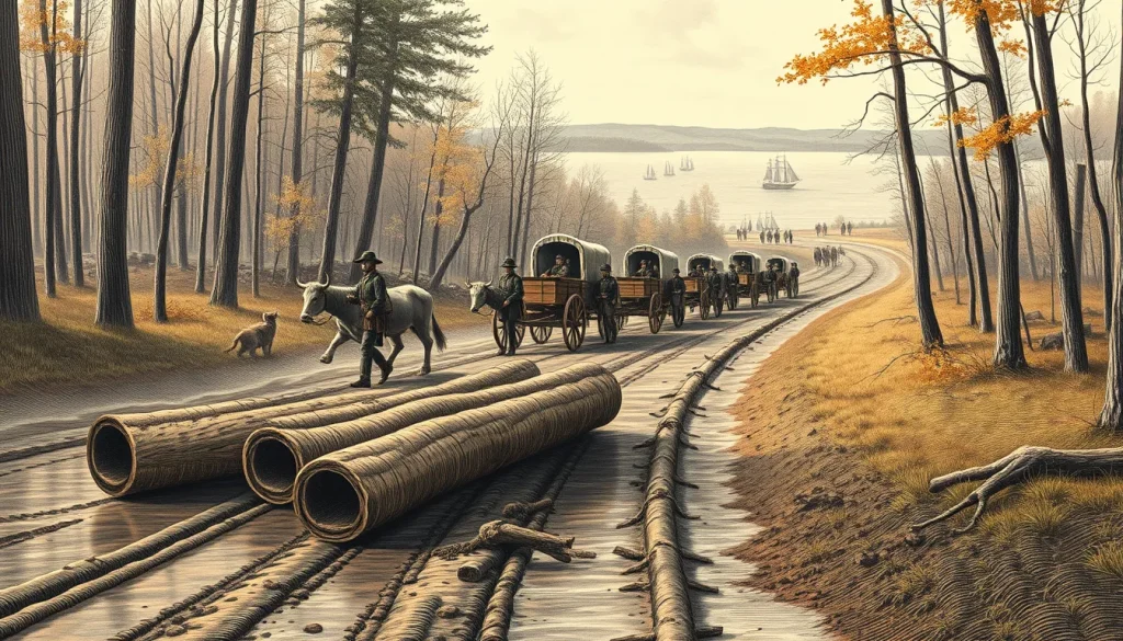
Road construction was undertaken for military needs, though modestly. The British built military roads connecting strategic posts in Upper Canada, such as the road from Kingston to York. Americans constructed corduroy roads—logs laid over swampy ground—to allow supply wagons to move across boggy areas. These efforts were temporary and labor-intensive.
Why It Matters
The state of roads and transportation directly affected the pace and outcome of military operations. American failures to conquer Canada are often attributed to logistical breakdowns caused by poor overland routes and underappreciation of the need for water transport. British control of the St. Lawrence and Lake Ontario, and their success in defending Lake Champlain, prevented American advances. The war demonstrated that modern military operations demanded better infrastructure, prompting post-war improvements like the Erie Canal and the National Road. Historians have long argued that the War of 1812 underscored the strategic interdependence of transportation and military success.
Definition
In the context of the War of 1812, “roads and transportation” encompasses the land and water routes used for moving troops, supplies, and equipment, as well as the practical means: foot, packhorse, wagon, boat, and ship.
Background
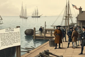
Before 1812, the United States had only a handful of engineered roads, mostly east of the Appalachians. In the west, roads were often mere traces. British North America had a similar pattern; the main communication artery between Upper and Lower Canada was the St. Lawrence River, with portages around rapids. Flat-bottomed bateaux were the standard cargo craft.
How It Worked
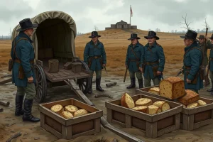
Armies moved on foot; officers rode horseback. Artillery and heavy loads required wagons, but only in dry weather. In wet seasons, roads became impassable, and soldiers often had to drag supplies or build temporary corduroy roads. Water transport was faster and could carry far larger loads. Both sides invested in building and arming vessels on the lakes; the Americans even transported ships around Niagara Falls on land to launch on Lake Erie. Indigenous allies used their knowledge of trails and river crossings to execute quick raids and avoid heavy marching.
Competing Viewpoints
American commanders frequently overestimated the ease of land transport and underestimated the value of controlling lakes. British commanders, with limited resources, prioritized naval control and close cooperation with Indigenous allies, who were skilled in mobile warfare. Some historians argue that the American failure to seize Canada was due to poor logistics rather than lack of military valor; others contend that British naval supremacy on Lake Ontario was the decisive factor. Contemporary American accounts often complained of bad roads, while British accounts emphasized the strength of their defensive positions.
Role in the War of 1812
Transportation shaped every campaign. The American surrender at Detroit was partly due to a tenuous supply line. The Battle of the Thames in October 1813 was fought after Perry’s fleet transported William Henry Harrison’s army across Lake Erie. The defeat at Chateauguay in 1813 came after American forces struggled through the woods and failed to bring up artillery. The successful American defense of Fort McHenry in Baltimore was aided by the ability of the U.S. Navy to control Chesapeake Bay access, while British raids on the coast relied on sea and river transport. In the Northwest, Indigenous leader Tecumseh’s coalition used mobile canoe and land movements that defied conventional transportation limits.
Consequences and Historical Interpretation
The war’s logistics lessons were not lost on postwar planners. The construction of the Erie Canal (1817–1825) was partly justified by the need to move supplies between the Hudson River and the Great Lakes, a route that had been difficult for soldiers and merchants alike. The National Road was extended westward, improving overland connectivity. Historians view the war as a case study in the importance of infrastructure; both sides’ failures and successes were often determined by their ability to move men and materiel. The demilitarization of the Great Lakes after the war reduced the naval race but also highlighted the continuing importance of these waterways for trade and transport.
Primary Sources
Contemporary military correspondence, such as letters between generals and the American Secretary of War, provide firsthand accounts of road conditions and supply difficulties. The papers of Sir George Prevost and Sir Isaac Brock, preserved in Canadian archives, document British logistical challenges. Soldiers’ journals and orderly books, like those kept by American regulars on the Niagara campaign, describe marching through mud and the constant need for repair of wagons. Naval officers’ reports from Lake Erie and Lake Champlain record the transport of ships and stores, offering insight into waterborne logistics. These sources are biased by their authors’ positions and must be read critically, but they are invaluable for reconstructing the transportation realities of 1812–1815.
Further Reading
- Donald R. Hickey, The War of 1812: A Forgotten Conflict (University of Illinois Press, 1989).
- J. Mackay Hitsman, The Incredible War of 1812: A Military History (University of Toronto Press, 1965).
- Walter R. Borneman, 1812: The War That Forged a Nation (HarperCollins, 2004).
- John R. Elting, Amateurs, to Arms! A Military History of the War of 1812 (Da Capo Press, 1991).
- Library and Archives Canada, Records of the War of 1812 (online collections).
References
- Hickey, Donald R. The War of 1812: A Forgotten Conflict. University of Illinois Press, 1989.
- Hitsman, J. Mackay. The Incredible War of 1812: A Military History. University of Toronto Press, 1965.
- Borneman, Walter R. 1812: The War That Forged a Nation. HarperCollins, 2004.
- Elting, John R. Amateurs, to Arms! A Military History of the War of 1812. Da Capo Press, 1991.
FAQ
Why were roads so poor during the War of 1812?
Most roads were little more than cleared trails, unmaintained and impassable in wet weather. Governments had limited budgets and labor for road construction, and the vast distances discouraged investment.
What role did Indigenous peoples play in transportation?
Indigenous warriors and guides provided essential knowledge of land routes, river crossings, and portages. Their mobility, often using canoes and forest trails, allowed rapid raids and reconnaissance that conventional armies could not match.
How did water transport affect the war's outcome?
Control of the Great Lakes and Lake Champlain proved decisive. The American naval victories on Lake Erie and Lake Champlain blocked British offensives and enabled American counterattacks, while British command of Lake Ontario protected Upper Canada.

Leave a Reply