Short Answer
The Niagara Frontier, a thirty-mile corridor along the Niagara River between Lake Erie and Lake Ontario, was the most heavily contested theatre of the War of 1812. Between 1812 and 1814, American, British, Canadian, and Indigenous forces fought a series of major battles and raids—including Queenston Heights, Lundy’s Lane, and the siege of Fort Erie—that produced thousands of casualties yet left the territorial boundary unchanged. Its strategic importance and the intensity of fighting made it the war’s bloodiest theatre.
Historical Context
The Niagara River formed a natural boundary between Upper Canada (now Ontario) and the state of New York. It was narrow enough to allow amphibious crossings at several points, and both sides established fortifications along its banks. Key sites included Fort George on the Canadian shore at the river’s mouth, Fort Niagara opposite it on the American side, Fort Erie at the head of the river on Lake Erie, and outposts at Queenston, Chippawa, and Black Rock. The region was also home to Indigenous peoples, particularly the Six Nations of the Iroquois, who largely allied with the British, hoping to check American expansion.
The American strategic objective was to invade Upper Canada and sever British supply lines, while the British and Canadian defenders sought to maintain control of the frontier as a defensive line. The declaration of war in June 1812 found the frontier garrisoned by small forces: the British had fewer than 1,000 regulars spread across the Upper Canada posts, supported by militia and Indigenous allies. The American forces were similarly small, but their militia was unreliable for offensive operations. The geography—with the Niagara Escarpment, dense forests, and the swift river—shaped every campaign, funneling attacks toward specific landing points and high-ground positions.
What Happened
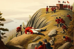
The first major engagement came on 13 October 1812, when American Major General Stephen Van Rensselaer launched an invasion from Lewiston across the river to Queenston. His troops seized the heights but suffered from a lack of reinforcements, as New York militia refused to cross into foreign territory. A British counterattack, led initially by Major General Isaac Brock, drove the Americans back, but Brock was killed during the assault. Lieutenant General Roger Sheaffe then arrived from Fort George with reinforcements and, after a brutal fight, forced the surviving Americans to surrender. The battle exposed the critical weakness of the American militia system and gave the British a celebrated victory.
The following year, 1813, opened with an American amphibious attack that captured Fort George on 27 May. The well-executed landing, supported by naval gunfire, succeeded in taking the fort, but the American commander, Henry Dearborn, failed to pursue the retreating British garrison. This allowed the British to regroup. On 6 June, British Lieutenant Colonel John Harvey surprised the American camp at Stoney Creek, capturing two American generals and causing the American force to retreat back toward Fort George. A week later, on 24 June, a large American column moving to cut off British retreat was ambushed at Beaver Dams by a force of Mohawk and Caughnawaga warriors, resulting in the surrender of 575 Americans. The Americans remained bottled up around Fort George for the rest of the year.
The war on the frontier took on a destructive turn in December 1813. On 10 December, American Brigadier General George McClure, retreating from Fort George, ordered the burning of Newark (modern Niagara-on-the-Lake), leaving some 400 families homeless in midwinter. This provoked a British retaliatory assault: on 19 December, British and Canadian forces captured Fort Niagara, and subsequent raids burned Lewiston, Black Rock, and Buffalo, inflicting severe damage on the American frontier. The cycle of violence culminated in the burning of Washington the following summer.
In 1814, the Americans returned with a rejuvenated army. Winfield Scott had drilled his regular brigade rigorously, and on 5 July, at the Battle of Chippawa, these regulars stood their ground against a British advance, demonstrating newly acquired discipline and professionalism. The battle was an American tactical victory. Three weeks later, on 25 July, the Battle of Lundy’s Lane near Niagara Falls became the war’s bloodiest engagement, with casualties exceeding 25 percent on both sides. The fighting continued into darkness, and both armies withdrew from the field, leaving the outcome indecisive. The Americans then fell back to Fort Erie and endured a British siege. A night assault on 15 August failed with heavy British losses, but the Americans, weakened and facing supply shortages, destroyed the fort and retreated across the river in November. The frontier remained exactly where it had been when the war began.
Why It Matters
The Niagara Frontier campaigns had immediate and lasting effects. They proved the strategic futility of the American invasion attempts, as no permanent territorial gain was made despite high casualties. The battles also showcased the crucial roles of militia and Indigenous forces: the refusal of American militia to cross the border at Queenston Heights, and the success of Indigenous warriors at Beaver Dams, influenced British tactics and American policy. At the same time, the 1814 campaigns, particularly Chippawa and Lundy’s Lane, marked the maturation of the American regular army, which would become the basis for professional military development after the war.
The destruction wrought in December 1813—the burning of Newark and the retaliatory raids—set a pattern of retaliation that escalated to the burning of Washington in August 1814. Later historians have also seen the Niagara campaign as a test of two rival systems: a citizen-militia force against a professional regular army, with the latter proving more effective. The memory of the frontier is preserved through monuments, battlefields, and historic sites that commemorate the sacrifices and the pivotal moments of the war.
Historical Map Context
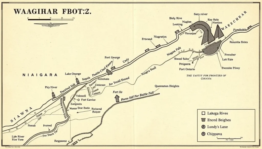
The Niagara Frontier is defined by the Niagara River, which flows northward for about 36 miles from Lake Erie to Lake Ontario. The river is broken by Niagara Falls, which divided the frontier into upper and lower halves. The lower section, from the falls to Lake Ontario, includes Queenston and Lewiston, where the Niagara Escarpment rises; the upper section includes Chippawa and Fort Erie. Maps from the period show the major fortifications—Fort George, Fort Niagara, Fort Erie—and the road networks connecting them. The narrow width of the river (about 600 yards at Queenston) made it a natural invasion corridor, but also made the crossing points predictable. A crucial detail in the maps is the position of Navy Island in the upper river, used for shipbuilding and as a staging ground.
Modern Location
The historic Niagara Frontier lies within the modern Niagara Region of Ontario and Niagara County, New York. Key present-day communities include Niagara-on-the-Lake, Queenston, St. Catharines, Fort Erie, Niagara Falls (both sides), Lewiston, Youngstown, and Buffalo. The Niagara Parks Commission in Canada and the New York State Office of Parks, Recreation and Historic Preservation preserve many of the war-era sites. The international boundary remains along the river, and the region is a major tourism and historical area.
Events at the Site
Besides the major battles, the Niagara Frontier saw numerous smaller skirmishes, raids, and occupations. The American capture of Fort George in May 1813, the night attack at Stoney Creek, and the ambush at Beaver Dams all occurred within a few miles of the river. The burning of Newark and the British raids on Lewiston and Buffalo were devastating. In 1814, the Battles of Chippawa and Lundy’s Lane took place on the Canadian side, while the siege of Fort Erie occupied the upper river. The frontier also served as a haven for smugglers and deserters, and a place of refuge for escaped slaves, though the latter is less documented. The constant military presence disrupted local farming and trade, causing hardship for civilians on both sides.
Associated People
Many notable military leaders served on the Niagara Frontier. On the British side, Major General Isaac Brock, the Lieutenant Governor of Upper Canada, was killed leading the counterattack at Queenston Heights; his second-in-command, Roger Sheaffe, completed the victory. Other British commanders included John Vincent, John Harvey, Phineas Riall, and Gordon Drummond. On the American side, Stephen Van Rensselaer and Alexander Smyth led the 1812 attempts; Henry Dearborn, Jacob Brown, Winfield Scott, and George McClure commanded in 1813–1814. Indigenous leaders, though less visible in archival records, played critical roles, particularly at Beaver Dams, where Caughnawaga and Mohawk warriors under Captain Dominique Ducharme ambushed an American column. Captain James FitzGibbon, whose British regulars arrived after the indigenous attack, acknowledged their decisive part in that action.
Surviving Monuments and Site
Many battlefields and fortifications are preserved today. Fort George National Historic Site in Niagara-on-the-Lake offers reconstructed buildings and exhibits. Fort Niagara State Park in Youngstown, New York, preserves the French Castle and ramparts. Queenston Heights Park, with Brock’s Monument, commemorates the 1812 battle and Brock’s death. Lundy’s Lane Battlefield in Niagara Falls has a museum and monument. Old Fort Erie, after its 1814 siege, has been partially restored. Other sites include Navy Island, a park island in the Niagara River, and various plaques and markers along the Niagara Parkway. Annual reenactments and heritage events keep the memory alive.
Primary Sources
Contemporary accounts include the journal of Captain W. H. Merritt of the Provincial Light Dragoons, which records events on the Niagara frontier from the British perspective, detailing the initial alarm after the declaration of war and the movements of forces. The Lundy’s Lane Historical Society’s Documentary History of the Campaign Upon the Niagara Frontier, edited by E. A. Cruikshank, compiles official reports, letters, and orders from both sides, providing a rich archival record. Benson J. Lossing’s Pictorial Field Book of the War of 1812 (1869) offers a later participant-adjacent narrative with illustrations and anecdotes. Official American and British army reports, published in the U.S. and Canadian archives, give the tactical details. These sources exhibit typical biases—patriotism, personal rivalries, and incomplete information—but together they allow historians to reconstruct events with reasonable confidence.
Further Reading
- Hickey, Donald R. The War of 1812: A Forgotten Conflict. University of Illinois Press, 1989.
- Latimer, Jon. 1812: War with America. Harvard University Press, 2007.
- Malcomson, Robert. Lundy’s Lane: The 1814 Battle of Niagara and the End of the War of 1812. Naval Institute Press, 2000.
- Benn, Carl. The Iroquois in the War of 1812. University of Toronto Press, 1998.
- Lossing, Benson J. The Pictorial Field-Book of the War of 1812. 1869. Available online.
- Cruikshank, E. A., ed. Documentary History of the Campaign Upon the Niagara Frontier. Lundy’s Lane Historical Society, 1896–1908.
References
- „The Niagara Campaign – War of 1812“, The War of 1812 Website. https://thewarof1812.org/campaigns/the-niagara-campaign/
- Lossing, Benson J. Pictorial Field Book of the War of 1812, Chapter XVIII and XIX. 1869. https://freepages.rootsweb.com/~wcarr1/history/Lossing2/Chap18.html, Chap19.html
- Merritt, W. H. Journal of Events Principally on the Detroit and Niagara Frontiers During the War of 1812. historical Society of B.N.A., 1863.
- Cruikshank, E. A., ed. Documentary History of the Campaign Upon the Niagara Frontier. Lundy’s Lane Historical Society, 1896. Internet Archive.
FAQ
Why was the Niagara Frontier strategically important in the War of 1812?
The Niagara Frontier was the narrowest link between the United States and Upper Canada, making it a prime invasion route. Controlling the river would allow either side to sever supply lines and dominate the Great Lakes region, making it the focus of repeated campaigns.
What was the impact of Isaac Brock's death at Queenston Heights?
Brock's death on 13 October 1812 deprived the British of their most charismatic and capable commander in Upper Canada. It also rallied British and Canadian morale, while for Americans it highlighted the failure of the invasion attempt and the militia crisis.
Did the Niagara Frontier campaigns change the border after the war?
No. After three years of fighting, the peace treaty returned the boundary to its pre-war status quo, and the Niagara Frontier remained exactly as it had been in 1812, despite the heavy loss of life and property destruction.


Leave a Reply