Short Answer
This research guide identifies and explains the principal printed and manuscript maps of the War of 1812, spanning the conflict from 1812 to 1815. It provides an orientation for researchers seeking maps of battlefields, naval engagements, frontier lines, and regional topography, and it notes key archival, library, and digital collections where these materials can be found. Because maps were integral to military planning and contemporary reporting, they offer unique evidence for understanding the spatial dimensions of the war.
Historical Context
The War of 1812 was fought across a vast and often poorly mapped landscape stretching from the Great Lakes and the St. Lawrence River to the Chesapeake Bay and the Gulf Coast. Both the United States and Great Britain relied on maps for strategic planning, troop movement, naval navigation, and diplomatic negotiation. In the early nineteenth century, cartography was advancing rapidly, but many regions—especially the borderlands—remained known only through earlier surveys, local knowledge, and reconnaissance. Military commanders on both sides often used maps that were incomplete, inaccurate, or based on outdated sources, leading to confusion and tactical errors. At the same time, commercial mapmakers in Philadelphia, London, and other cities quickly produced and sold maps of the conflict to a public eager to follow the war.
What Happened
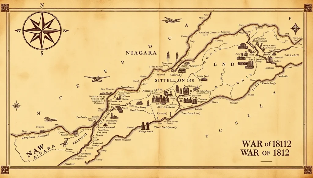
Throughout the war, military engineers and commanders created manuscript maps and sketches for campaigns such as the Niagara frontier, the Battle of Lake Erie, the defense of Baltimore, and the Battle of New Orleans. These included detailed plans of fortifications, routes of march, naval operations, and topography. Some were published after the war in official reports, memoirs, and atlases, while others remained in archives. Notable published works include William James’s Full and Correct Account of the Military Occurrences of the Late War (1818), which contains plans of Battles, and John Melish’s Military and Topographical Atlas (1815), which provided broad regional overviews. Commercial cartographers like Joseph Bouchette, Samuel Lewis, and Edward Baines also produced maps for the public. In the post-war era, historians and mapmakers continued to create maps illustrating the war for books and atlases, some of which have become standard refences.
Why It Matters
Maps of the War of 1812 are essential primary sources for reconstructing the geography of the conflict, verifying troop movements, and understanding the perspectives of participants. They reveal what military leaders knew (or thought they knew) about terrain, distances, and settlements. Maps also had a public role, shaping civilian understanding of the war and sometimes serving as propaganda. For modern historians, maps offer a visual record that complements textual accounts and archaeological evidence. However, maps must be used carefully: they reflect the cartographer’s biases, sources, and technical limitations, and they can sometimes be deliberately misleading for strategic or political purposes.
Definition
A research guide to the maps of the War of 1812 is a curated reference work that identifies, organizes, and explains the available map resources—both original and digital—for studying the conflict. Such guides typically list published and manuscript maps, locate them in archives or libraries, and offer guidance on how to access them. They may also discuss the cartographic features of the maps, their historical context, and their research value.
Background
The systematic compilation of War of 1812 maps began with scholarly interest in the conflict. As early as the 19th century, historians like Benson Lossing used maps to illustrate their narratives. In the 20th century, archives such as the Library of Congress, the National Archives of the United States, Library and Archives Canada, and the British National Archives acquired substantial collections. Published cartobibliographies, such as Mapping the War of 1812: A Preliminary Cartobibliography, attempted to list known maps but acknowledged incompleteness. In recent years, digital projects like the Lilly Library’s online collection and the War of 1812 Bicentennial website have made many maps freely accessible online.
How It Worked
Researchers seeking War of 1812 maps typically begin with published guides and archival catalogs. For example, the Brock University Library’s research guide provides a curated list of map resources, including digital links. The Maryland Center for History and Culture’s guide includes a section on maps within broader research themes, noting specific map collections. The Dyasites cartobibliography organizes maps by date of publication or type, offering a starting point for identifying individual maps. Once a specific map is identified, researchers must consult the holding institution—whether a library, archive, or museum—for access. Many institutions offer high-resolution digital scans, which can be used online. Researchers should also consider manuscript maps, often unpublished, which require travel to the repository or the use of microform copies.
Competing Viewpoints
Historians debate the accuracy and reliability of War of 1812 maps. Some maps were based on direct observation and were relatively accurate for their time; others were compilations from older sources or second-hand accounts, leading to errors. Competing viewpoints also exist over interpretation: a map prepared by a British officer might show troop movements differently than an American map, reflecting distinct operational perspectives and tactical priorities. Additionally, some maps were propaganda, exaggerating victories or minimizing losses. Researchers must cross-reference maps with written reports and other evidence to assess their trustworthiness.
Role in the War of 1812
During the war, maps served multiple military functions. Commanders relied on maps to plan invasions, identify defensive positions, and coordinate naval movements. For instance, Sir George Prévost’s decision to invade New York via Lake Champlain was influenced by maps and available reconnaissance, and the Battle of Lake Erie was fought using charts of the lake and its islands. Maps also played a role in diplomacy, as territorial claims and boundary disputes were often represented cartographically. After the war, commission members used maps to settle boundaries along the Great Lakes and the St. Lawrence River. Additionally, maps were sold to the public, fostering a civilian understanding of the war’s geography.
Consequences and Historical Interpretation
The availability and accuracy of maps had direct consequences for the conduct of the war. Poor maps contributed to missteps, such as General William Hull’s invasion of Canada in 1812, where uncertain roads and terrain hampered his advance. Conversely, good maps enabled effective operations, as seen in the Battle of New Orleans, where detailed local knowledge of the terrain gave American forces an advantage. In the long term, the war prompted improved cartographic surveys of the bordering regions, contributing to the later development of national mapping programs. Historians today use these maps to analyze strategy, identify battlefield positions, and challenge or confirm accounts of the war. The maps also offer insights into how contemporaries imagined the geography of the conflict, which is an important aspect of historical memory.
Primary Sources
The most relevant primary sources are the actual maps, both manuscript and printed. Repositories include the Library of Congress, the U.S. National Archives, Library and Archives Canada, the British National Archives, and state and local historical societies. The Brock University Library research guide provides a curated list of maps and links. The Maryland Center for History and Culture’s guide includes a section on maps in its broader resource inventory. The Lilly Library’s online collection contains digitized maps, such as the “New correct map of the seat of war in Lower Canada” and “Sketch of the march of the British Army under Gen’l Ross.” The Dyasites cartobibliography attempts a comprehensive listing of published maps from the era. A key limitation is that many maps are scattered, and some are only available in print or on microfilm; digitization is ongoing but incomplete.
Further Reading
- David Sharron, “Research Guides: War of 1812: Maps,” Brock University Library. http://researchguides.library.brocku.ca/c.php?g=99809&p=645696
- “Guide to the War of 1812 Sources,” Maryland Center for History and Culture. PDF
- “Browse Items · The War of 1812 in the Collections of the Lilly Library,” Indiana University. https://collections.libraries.indiana.edu/warof1812/
- “Mapping the War of 1812: A Preliminary Cartobibliography,” Dyasites. https://www.dyasites.com/maps/1812.htm
- “List of all Maps,” War of 1812 Bicentennial. http://warof1812-bicentennial.info/imagedesc/maps.php
References
- Sharron, David. “Research Guides: War of 1812: Maps.” Brock University Library. Accessed October 2023. http://researchguides.library.brocku.ca/c.php?g=99809&p=645696
- “Guide to the War of 1812 Sources.” Maryland Center for History and Culture, 2020. https://www.mdhistory.org/wp-content/uploads/2023/10/GuideToWarOf1812Resources_2020.pdf
- “Browse Items · The War of 1812 in the Collections of the Lilly Library.” Indiana University, Lilly Library. Accessed October 2023. https://collections.libraries.indiana.edu/warof1812/items/browse?collection=12
- “Mapping the War of 1812: A Preliminary Cartobibliography.” Dyasites. Accessed October 2023. https://www.dyasites.com/maps/1812.htm
- “List of all Maps.” War of 1812 Bicentennial. Last updated February 5, 2015. http://warof1812-bicentennial.info/imagedesc/maps.php
FAQ
Where can I find maps of the War of 1812 online?
Many maps are digitized in the Lilly Library collection at Indiana University, the Library of Congress, and the War of 1812 Bicentennial website. Research guides such as the Brock University Library guide also provide links.
How reliable are War of 1812 maps?
Reliability varies. Some were based on direct surveys and are fairly accurate; others were compiled from older sources or second-hand reports. Always cross-reference with written records and consider the mapmaker's perspective.
What types of maps were produced during the War of 1812?
Maps included battle plans, route maps, naval charts, topographic surveys, and broad regional maps. They served military planning, public information, and post-war boundary negotiations.


Leave a Reply