Short Answer
The Passamaquoddy Bay Islands Dispute was a territorial disagreement between the United States and Great Britain over the ownership of islands in Passamaquoddy Bay, part of the Bay of Fundy, which arose from the ambiguous wording of the 1783 Treaty of Paris and remained unresolved until the War of 1812’s Treaty of Ghent provided for its arbitration. The resulting 1817 commission decision awarded three islands to the United States and all others to Great Britain, setting a precedent for international arbitration. Though often overshadowed by other War of 1812 issues, the dispute represents a key example of how the conflict’s peace treaty addressed long-standing boundary questions.
Historical Context
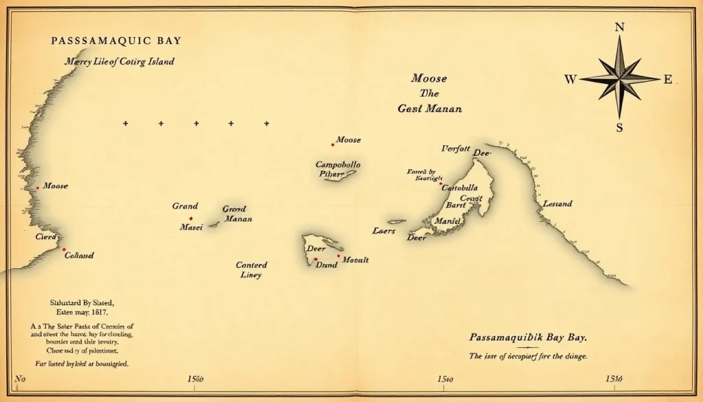
The Treaty of Paris (1783), which ended the American Revolutionary War, defined the boundary between the United States and British North America along the St. Croix River and its northern extension, but the treaty’s wording left several ambiguities. The river called the St. Croix was not clearly identified, and no provision was made for the numerous islands in Passamaquoddy Bay, which the river feeds. The 1794 Jay Treaty attempted to clarify the boundary by establishing a commission to identify the correct St. Croix River. Between 1796 and 1798, that commission, operating under the fifth article of the Jay Treaty, determined that the present-day St. Croix River, flowing into Passamaquoddy Bay, was the intended boundary. It also fixed the source of the river at the Chiputneticook Lakes. However, the commission did not address the sovereignty of the islands in the bay, which were claimed by both sides. These islands—including Moose Island, Deer Island, Campobello Island, and Grand Manan—were valuable for fishing, trade, and strategic position at the entrance to Canadian waters. The ambiguity remained a source of friction between the United States and Great Britain in the early 19th century, and it was not resolved until after the War of 1812.
What Happened
The War of 1812 ended with the Treaty of Ghent, signed on December 24, 1814. That treaty included four articles intended to settle outstanding boundary disputes between the United States and British North America. Article IV specifically addressed the islands in Passamaquoddy Bay, which it described as “part of the Bay of Fundy,” and directed that a commission of two members—one appointed by each side—determine to which party each island belonged, in conformity with the true intent of the second article of the Treaty of Paris. The United States appointed John Holmes, a Massachusetts politician and later congressman from Maine. Great Britain appointed Thomas Barclay, a loyalist-born New Brunswicker who had served in the previous boundary commission. The commissioners were sworn to examine evidence and decide impartially. They met in New York and considered claims based on historical settlement, prior ownership, and the treaty’s language. On November 24, 1817, they issued a unanimous decision: Moose Island, Dudley Island, and Frederick Island (the last two near Moose Island) belonged to the United States; all other islands in Passamaquoddy Bay, including Deer Island, Campobello Island, and Grand Manan, belonged to Great Britain. In a covering letter, the commissioners noted that they had each yielded part of their individual opinions and expressed the belief that the navigable waters of Passamaquoddy Bay were common to both parties for lawful communication with their territories and foreign ports.
Why It Matters
The decision mattered immediately because it fixed the international boundary at a sensitive maritime point and assigned sovereignty over islands that had been under contested claims for decades. It recognized existing settlement patterns: Moose Island, which had a growing American community (later the town of Eastport, Maine), became American, while islands with loyalist settlements such as Deer and Campobello remained British. The commissioners’ compromise also avoided a rupture in Anglo-American relations. More broadly, the Passamaquoddy Bay arbitration set a precedent for peaceful resolution of boundary disputes through joint commissions, a mechanism later used for other contentious parts of the U.S.-Canada frontier. Long-term, the decision helped define the present-day border between Maine and New Brunswick, though the exact maritime boundary beyond the bay remained a matter of negotiation until the 1890s. Historians often treat the dispute as a minor footnote, yet it demonstrates how the War of 1812’s peace settlement extended beyond military and naval concerns to resolve the territorial ambiguities that had caused friction for years.
Definition
The Passamaquoddy Bay Islands Dispute was a diplomatic-legal disagreement over the sovereignty of the islands situated in Passamaquoddy Bay, which is an arm of the Bay of Fundy, between what is now Maine and New Brunswick. It was rooted in the imprecise boundary description in the 1783 Treaty of Paris and was ultimately resolved by arbitration under Article IV of the Treaty of Ghent.
Background
The dispute’s origins lay in the eighteenth-century cartographic ignorance of the region. The 1783 treaty specified that the boundary would run “from the northwest angle of Nova Scotia, viz. that angle which is formed by a line drawn due north from the source of the St. Croix River to the highlands… along the said highlands… and then along the middle of the said river (St. Croix) to the Bay of Fundy,” but it did not name the islands or allocate them. The Jay Treaty provision created a commission to identify the St. Croix, which it did in 1798, but the islands were not included in its mandate. As settlement increased after the American Revolution, both nations laid claim to the islands. British authorities in New Brunswick considered the islands part of their province; Americans saw them as part of Maine. The issue became a matter of local friction and a legal case when the British Vice-Admiralty Court in Saint John seized an American vessel, the sloop Falmouth, in 1805, leading to a published pamphlet arguing the American claim.
How It Worked
The arbitration mechanism established by Article IV of the Treaty of Ghent involved two commissioners, one from each nation, who took an oath to examine the evidence impartially. They were to decide to which party each island belonged “in conformity with the true intent” of the 1783 treaty. The commissioners heard testimonies, examined historical records, and considered the geography of the bay. They faced the challenge of interpreting a treaty that had not addressed the islands at all. In their decision, they balanced the principle of prior possession and actual settlement: areas with American settlers went to the U.S., while areas with British loyalist settlers went to Britain. The commission functioned without a third-party arbitrator, thus requiring mutual concession.
Competing Viewpoints
The American position, as articulated in the 1805 pamphlet and in evidence submitted to the commissioners, held that the 1783 treaty’s phrase “true intent” included all islands lying within the boundaries of the United States as then defined, and that the St. Croix River’s mouth included the islands in Passamaquoddy Bay. The British position insisted that the treaty had only transferred the mainland territory and that all islands not explicitly granted remained Crown property. Moreover, the British argued that the bay’s islands had been part of Nova Scotia/New Brunswick from early colonial times, and that loyalist grants and settlement gave them a superior claim. The commissioners’ decision reflected a compromise: each nation received islands it had effectively occupied, and the principle of navigational freedom for both was affirmed.
Role in the War of 1812
The dispute was not a direct cause of the War of 1812, but it was one of several unresolved boundary and maritime issues that contributed to Anglo-American tensions. During the war, the islands themselves were not a major theater, but British naval forces controlled the Bay of Fundy, and American privateers occasionally operated in the region. The war’s conclusion brought the boundary question to the forefront, because the Treaty of Ghent sought to prevent future conflicts by resolving underlying disputes. Article IV of the treaty specifically tasked the arbitration of the Passamaquoddy Bay islands, making it one of the few boundary provisions to be settled quickly and successfully. In this sense, the dispute was both a product of the pre-war period and a consequence of the war’s diplomacy.
Consequences and Historical Interpretation
The immediate consequence was a clear territorial allocation: the United States retained Moose, Dudley, and Frederick Islands, and Great Britain retained the rest, including Grand Manan. The decision also implicitly established a principle of shared navigation in the bay. Long-term, it contributed to the peaceful resolution of other frontier disputes through similar joint commissions, as seen in later negotiations over the Maine-New Brunswick border, eventually settled by the Webster-Ashburton Treaty of 1842. Historians have generally viewed the Passamaquoddy Bay arbitration as a successful example of bilateral dispute resolution. Some scholars note that the commission’s pragmatic approach—prioritizing actual settlement over strict treaty interpretation—foreshadowed later international boundary practice. Although the dispute is often considered “forgotten,” it remains a case study in early nineteenth-century diplomacy and territorial compromise.
Primary Sources
The most significant primary source is the Decision of the Commissioners under Article IV of the Treaty of Ghent, signed at New York on November 24, 1817, along with the covering letter to Secretary of State John Quincy Adams. The full text is available in John Bassett Moore’s International Adjudications, Modern Series (Volume VI) and in Hunter Miller’s Treaties and Other International Acts of the United States (Volume 2). The Avalon Project at Yale provides a digitized transcript. A related source is the pamphlet The Question respecting the right of the United States of America to the islands in Passamaquoddy-Bay (1805), which argued the American case after the seizure of the sloop Falmouth. Additionally, the papers of Thomas Barclay and John Holmes, held in archives such as the Maine Historical Society and the Barclay Collection, offer insights into the commission’s deliberations. These sources provide the documentary basis for understanding the dispute, but they are partisan documents, and their claims must be weighed against each other.
Further Reading
- Moore, John Bassett, ed. International Adjudications, Ancient and Modern: Modern Series, Vol. VI. New York: Oxford University Press, 1933.
- Miller, Hunter, ed. Treaties and Other International Acts of the United States of America, Vol. 2. Washington: Government Printing Office, 1931.
- Hornsby, Stephen J. “Negotiating the International Boundary.” In Historical Atlas of Maine. Orono: University of Maine Press, 2015.
- Demeritt, David. “Representing the ‘True’ St. Croix: Knowledge and Power in the Boundary Dispute.” Canadian Historical Review 84, no. 3 (2003): 381-422.
- Mendenhall, T. C. Twenty Unsettled Miles in the Northeast Boundary. Worcester: American Antiquarian Society, 1897.
References
- “Decision under Article IV of the Treaty of Ghent of 1814 between the United Kingdom and the United States, relating to the Islands in the Bay of Fundy, decision of 24 November 1817.” Reports of International Arbitral Awards, Vol. XXVIII, United Nations, 2007. https://legal.un.org/riaa/cases/vol_XXVIII/5-10.pdf
- “Decision of the Commissioners under Article 4 of the Treaty of Ghent.” Avalon Project, Lillian Goldman Law Library, Yale University. https://avalon.law.yale.edu/19th_century/ghentcom.asp
- “Fixing Borders on the Land: The Northeastern Boundary in Treaties and Local Reality, 1763-1842.” Beyond Borders, Maine Memory Network, Maine Historical Society. https://beyondborders.mainememory.net/page/5189/display%3Fpage=3.html
- Mendenhall, Thomas C. Twenty Unsettled Miles in the Northeast Boundary. Project Gutenberg eBook, 2020. https://www.gutenberg.org/cache/epub/63443/pg63443-images.html
- The Question respecting the right of the United States of America to the islands in Passamaquoddy-Bay. Saint John, N.B.: 1805. Canadiana. https://www.canadiana.ca/view/oocihm.92469
FAQ
Why was the Passamaquoddy Bay Islands Dispute unresolved before the War of 1812?
The 1783 Treaty of Paris defined the boundary along the St. Croix River but did not specify which islands belonged to which nation. The Jay Treaty commission only identified the correct river, not the islands, leaving a legal ambiguity that persisted into the early 19th century.
What was the outcome of the 1817 commission?
The commission awarded Moose, Dudley, and Frederick Islands to the United States, and all other islands in Passamaquoddy Bay, including Grand Manan, to Great Britain. They also declared the bay's navigable waters open to both parties for lawful trade and communication.
How did this dispute affect later U.S.-Canada border negotiations?
The Passamaquoddy Bay arbitration demonstrated the value of joint commissions for resolving territorial disputes. Its success influenced later boundary negotiations, such as the Webster-Ashburton Treaty of 1842, which addressed the remaining Maine-New Brunswick border.




Leave a Reply