Short Answer
Lake Champlain, a long, narrow lake situated between the U.S. state of Vermont and New York, with its northern end extending into Quebec, served as a critical invasion corridor during the War of 1812. This lake, connecting the Richelieu River and the St. Lawrence to the north and the Hudson River valley to the south, became the focus of naval operations, shipbuilding, and ultimately the pivotal Battle of Plattsburgh on September 11, 1814. That battle prevented a major British invasion and had lasting diplomatic consequences. This article examines the lake’s strategic role, the course of the war there, and its historical significance.
Historical Context
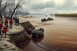
During the early national period, Lake Champlain offered the easiest north–south route for military movements between British North America and the United States. Its waters allowed transport of troops and supplies with far greater ease than overland travel through the rugged terrain. Consequently, both sides recognized early that control of the lake would determine the success of any invasion attempt. Prior to the war, the U.S. Navy had built two row galleys in 1808 to enforce trade restrictions, and the War Department acquired several sloops for provincial use. As war broke out, Lieutenant Thomas Macdonough was ordered to organize a naval force on the lake, initially using these vessels primarily for transport.
The strategic picture changed drastically in 1814 after Napoleon’s defeat in Europe released British veterans for service in North America. Governor General Sir George Prévost planned to invade southward through the Champlain Valley, intending to seize Plattsburgh and advance toward Albany, thus isolating New England from the rest of the United States. To support this offensive, a powerful British naval squadron was to gain control of the lake.
What Happened
The first direct naval engagement on the lake occurred on July 3, 1813, when two American sloops, USS Growler and USS Eagle, were captured by a British force in the Richelieu River. The vessels were later repaired and incorporated into the British fleet. Following this setback, Macdonough secured permission to purchase additional vessels and, in December 1813, moved his growing fleet to Vergennes, Vermont, on Otter Creek. This location offered abundant timber, iron forges, and waterfalls for power, making it ideal for shipbuilding. Over the subsequent months, American shipwrights constructed the corvette USS Saratoga (26 guns), the schooner USS Ticonderoga (17 guns), and six 70-ton row galleys, among others.
The British also expanded their fleet at Isle aux Noix, building the brig HMS Linnet and the large frigate HMS Confiance (37 guns), the largest warship ever built on the lake. In May 1814, a British squadron attempted to attack the American shipyard by approaching the mouth of Otter Creek, but was repulsed by the guns of Fort Cassin. Throughout the summer, the American fleet patrolled and escorted supply bateaux between Plattsburgh and Burlington.
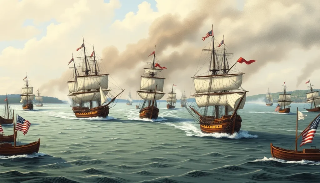
The climax came on September 11, 1814, when Captain George Downie led the British squadron into Plattsburgh Bay to support Prévost’s land assault. Macdonough had deployed his ships in a north–south line behind a point of land, using kedge anchors and spring lines—a system that allowed each vessel to rotate in place. This enabled the Americans to bring fresh broadsides to bear when their original firing side became disabled. The battle raged for over two hours. When the Saratoga’s starboard battery was dismounted, Macdonough cut her cable and winded the ship, presenting an intact port battery against the Confiance. The British flagship, attempting a similar maneuver, stalled and was subjected to devastating fire, leading to its surrender. Downie was killed early in the action. The rest of the British squadron struck its colors. Seeing the naval defeat, Prévost canceled the planned land assault and retreated to Canada, despite the protests of his brigade commanders who believed they could take the American defenses.
Why It Matters
The American victory at Plattsburgh Bay was strategically decisive. It thwarted the largest British offensive of the war and effectively ended major operations in the northern theater. The defeat weakened British territorial claims during peace negotiations at Ghent; the Treaty of Ghent, signed in December 1814, restored the status quo ante bellum, with neither side gaining territory. Some historians argue that the battle saved the United States from potential partition, while others emphasize that the treaty restored pre-war borders regardless. The battle also had a lasting impact on naval warfare, as Macdonough’s use of spring-line anchoring became a studied tactic. Prévost was recalled to face a court-martial for his retreat but died before proceedings began. The memory of the battle is preserved in monuments, museums, and ongoing research.
Historical Map Context
Lake Champlain runs roughly 120 miles from Whitehall, New York, in the south to the Richelieu River in Quebec. Key locations include Isle aux Noix, the British naval base near the northern end; Otter Creek, where the Americans built their fleet at Vergennes; Cumberland Head, marking the western approach to Plattsburgh Bay; and Crab Island, at the southern end of the American line. The lake’s shape and prevailing winds influenced where the battle was fought and how the fleets maneuvered.
Modern Location
Lake Champlain still forms the boundary between New York and Vermont, and extends into Quebec. The city of Plattsburgh, New York, lies on the western shore near the battle site. Vergennes, Vermont, remains a small city at the falls on Otter Creek. The lake is now a popular recreation area, with several museums and historic sites dedicated to the war-era history.
Events at the Site
Beyond the 1814 battle, the lake witnessed earlier British raids in 1813 against Plattsburgh, Point au Roche, Swanton, Chazy, and surrounding communities; these raids burned public buildings and seized private property. The American shipyard at Vergennes produced the Saratoga and Ticonderoga. Fort Cassin defended the mouth of Otter Creek against a British sortie on May 14, 1814. Smuggling and illegal trade continued along the lake throughout the war.
Associated People
Thomas Macdonough commanded the American squadron; George Downie (who was killed in action) commanded the British squadron; George Prévost was the British army commander; Alexander Macomb led the American land defenses at Plattsburgh. Notable shipwrights and officers included Robert Henley (commander of the USS Eagle) and Cassin (commanding the Ticonderoga). British naval officers such as Daniel Pring also played roles.
Surviving Monuments and Site
The War of 1812 Museum in Plattsburgh offers exhibits, a diorama, and a painting by Julian Oliver Davidson. Crab Island contains the Soldiers and Sailors Monument, with an unmarked mass grave of about 150 sailors and soldiers from both sides. Fort Cassin, though less preserved, is marked by interpretive signs. The Lake Champlain Maritime Museum in Vergennes displays artifacts and ship models. The battle site itself is marked by buoys and interpretive panels.
Primary Sources
Macdonough’s official report to Secretary of the Navy William Jones, dated September 11 and 13, 1814, is the central American account of the battle. The Navy Department transmitted these documents to Congress on October 6, 1814. British sources include court-martial testimony from Prévost and others, and the despatches of Captain Daniel Pring. Civilian witness J.C. Hubbell wrote a graphic description of the firing. These sources offer both operational details and perspectives on leadership.
Further Reading
- Hickey, Donald R. The War of 1812: A Forgotten Conflict (1989).
- Berton, Pierre. Flames Across the Border (1981).
- Wilder, Patrick. The Battle of Plattsburgh (2013).
- Lake Champlain Maritime Museum’s resources on the War of 1812.
References
- Lake Champlain Maritime Museum, “War of 1812 (1812-1815),” https://www.lcmm.org/explore/lake-champlain-history/war-of-1812-1812-1815/
- National Park Service, “Autumn 1814: The British Navy suffers a decisive defeat at the Battle of Lake Champlain,” https://www.nps.gov/articles/battle-of-lake-champlain.htm
- The War of 1812 Website, “The Plattsburgh & Lake Champlain Campaign,” https://thewarof1812.org/campaigns/the-plattsburgh-lake-champlain-campaign/
- Official report of Thomas Macdonough, published in American State Papers, “Capture of the British Fleet on Lake Champlain” (1814), accessible at https://ibiblio.org/pha/USN/1814/18141006Champlain.html
FAQ
What was the strategic importance of Lake Champlain in the War of 1812?
Lake Champlain was the natural invasion route between British Canada and the United States. Controlling the lake allowed an army to move supplies and troops north or south, making it a critical objective for both sides.
What was Macdonough's key tactic in the Battle of Plattsburgh?
Macdonough used kedge anchors and spring lines to rotate his ships in place, enabling him to bring fresh broadsides to bear when the original firing side was disabled. This proved crucial when his flagship Saratoga's starboard battery was disabled, allowing him to wind the ship and continue the fight.
Why did Prévost retreat after the naval defeat?
Sir George Prévost called off the land assault and retreated because he believed that without control of the lake, his army's advance toward Albany would be vulnerable to supply interdiction and attack. His decision was controversial, as his brigade commanders argued the land defenses could be taken.

Leave a Reply