Short Answer
Horseshoe Bend Battlefield is the location of the Battle of Horseshoe Bend, fought on March 27, 1814, on a peninsula of the Tallapoosa River in present-day Alabama. This battle was the decisive engagement of the Creek War (1813–1814), which itself formed part of the broader War of 1812, and resulted in a decisive American victory under Major General Andrew Jackson. The battlefield is now preserved as Horseshoe Bend National Military Park, a unit of the National Park Service.
Historical Context
The Creek War began as a civil conflict within the Muscogee (Creek) Nation, largely driven by the divide between the Upper Creeks and Lower Creeks over relations with the United States. The Red Sticks, a nativist and conservative faction from the Upper Towns, opposed the growing American influence and the assimilation policies promoted by U.S. Indian Agent Benjamin Hawkins. They derived their name from their red ceremonial war clubs. In August 1813, Red Sticks attacked and overwhelmed Fort Mims in present-day Alabama, killing most of the Lower Creek inhabitants and white settlers who had taken refuge there. This massacre galvanized the United States, prompting military responses from Tennessee, Georgia, and the Mississippi Territory. Tennessee militia commander Andrew Jackson led a campaign into Creek territory, but the war was not concluded until the decisive confrontation at Horseshoe Bend.
What Happened
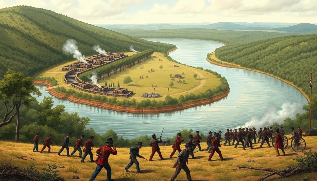
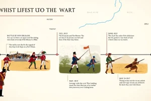
On March 27, 1814, Jackson’s army of about 3,300 men attacked Chief Menawa’s force of roughly 1,000 Red Stick warriors, who had fortified themselves in a horseshoe-shaped bend of the Tallapoosa River. The Red Sticks had constructed an elaborate barricade across the narrow neck of the peninsula, and the river protected the rear. Jackson deployed a detachment to cross the river and attack from behind, while another force launched a frontal assault. Cherokee allies, including a group of three who swam across the river and captured Red Stick canoes, ferried warriors to the rear, causing confusion. The frontal assault then broke through the barricade. Over 800 Red Sticks died, while American losses were about 49 killed and 154 wounded. The battle effectively destroyed Red Stick military power.
Why It Matters
The Battle of Horseshoe Bend ended the Creek War, and the subsequent Treaty of Fort Jackson (August 9, 1814) forced the Creeks to cede about 23 million acres of land to the United States. This opened the Mississippi Territory to white settlement and removed a major obstacle to American expansion in the Southeast. The victory made Andrew Jackson a national hero and propelled him toward the presidency. For the Creek Nation and other Indigenous peoples, the battle and treaty marked a catastrophic loss of homeland and sovereignty, setting a precedent for forced removal. Historians interpret the battle as both a key military victory in the War of 1812 and a tragic episode in the dispossession of Native Americans.
Historical Map Context
The site is a peninsula formed by a sharp bend in the Tallapoosa River, which curves around it in a shape resembling a horseshoe. The Red Sticks fortified the neck of the peninsula with a breastwork of logs and earth, and also built a village called Tohopeka within the bend. The river at this point was deep and fast-flowing, providing a natural defense on three sides. The terrain included wooded slopes and ravines.
Modern Location
Horseshoe Bend National Military Park is located at 11288 Horseshoe Bend Road, Daviston, Alabama, 36256. The park preserves more than 2,000 acres of the original battlefield and is part of the National Park Service. Visitors can explore the site via a 3-mile driving tour and a 2.8-mile nature trail that passes near the Tohopeka village site.
Events at the Site
On March 27, 1814, the site witnessed the climactic battle of the Creek War. After the battle, the Red Stick stronghold was destroyed, and hundreds of warriors were killed or captured. The site remained largely unchanged for decades, and in 1959 it was designated a National Military Park. Today, it is used for historical interpretation, hiking, and commemorative events.
Associated People
Key individuals associated with the site include Major General Andrew Jackson, commander of American forces; Chief Menawa, the Red Stick leader; William Weatherford (Red Eagle), a prominent Red Stick leader who surrendered after the battle; and the Cherokee allies who fought alongside Jackson, including the group that crossed the river, sometimes identified as Tuq-qua (The Whale) and others. U.S. Indian Agent Benjamin Hawkins also played a role in the lead-up to the conflict.
Surviving Monuments and Site
The park features a visitor center with exhibits and an introductory video, a self-guided driving tour, a nature trail, picnic areas, and a boat ramp. The battlefield landscape is preserved, and interpretive markers explain the action. The site also includes the Tohopeka village area, marked by a trail. No original fortifications survive, but the terrain is largely intact.
Primary Sources
Contemporary accounts of the battle include Andrew Jackson’s own description of the site, quoted on the National Park Service website: “This bend which resembles in its curvature that of a horse-shoe, includes, I conjecture, eighty or a hundred acres. The River immediately around it, is deep, & somewhat upwards of a hundred yards wide. As a situation for defense it was selected with judgment, & improved with great industry and art.” Jackson’s official report to the Secretary of War, dated March 31, 1814, provides military details and casualty figures. Cherokee participants later recounted their role, though these oral histories were recorded after the fact. The primary sources are limited to American and allied perspectives; Red Stick accounts are sparse and often filtered through later interviews.
Further Reading
- National Park Service. Horseshoe Bend National Military Park. https://www.nps.gov/hobe/index.htm
- American Battlefield Trust. Horseshoe Bend. https://www.battlefields.org/visit/battlefields/horseshoe-bend
- Moore, Ethan. “Spring 1814: The Battle of Horseshoe Bend.” National Park Service. https://www.nps.gov/articles/behind-the-sharp-knife.htm
- National Park Service. “Alabama: Horseshoe Bend National Military Park.” https://home.nps.gov/articles/horseshoebend.htm
References
- National Park Service. “Horseshoe Bend National Military Park.” Accessed 2026. https://www.nps.gov/hobe/index.htm
- American Battlefield Trust. “Horseshoe Bend.” Accessed 2026. https://www.battlefields.org/visit/battlefields/horseshoe-bend
- Moore, Ethan. “Spring 1814: The Battle of Horseshoe Bend.” National Park Service, 2017. https://www.nps.gov/articles/behind-the-sharp-knife.htm
- National Park Service. “Alabama: Horseshoe Bend National Military Park.” Accessed 2026. https://home.nps.gov/articles/horseshoebend.htm
FAQ
What was the significance of the Battle of Horseshoe Bend?
The battle ended the Creek War and led to the Treaty of Fort Jackson, ceding 23 million acres of Creek land to the United States, opening the Southeast for settlement, and propelling Andrew Jackson to national prominence.
Who fought at the Battle of Horseshoe Bend?
American forces under Andrew Jackson, including Tennessee militia, U.S. regulars, and allied Cherokee and Lower Creek warriors, fought against the Red Stick faction of the Upper Creek Nation led by Chief Menawa.
Can I visit Horseshoe Bend Battlefield today?
Yes, the site is preserved as Horseshoe Bend National Military Park in Daviston, Alabama, with a visitor center, driving tour, nature trail, and interpretive programs.
Leave a Reply